
Blyde River Canyon Nature Reserve - 3 Day Trail

Map: You receive one upon arrival. I would highly advise using digital GPS as we often found ourselves off the path as the routes are not maintained. There are painted yellow markers the whole way, but they are not always visible. These markers are not present when you reach a network of gravel roads that you need to navigate. I use Maps.me which was great.
Info Sheet: When enquiring you are sent an info sheet, but we discovered that much of what it contained was either outdated or incorrect. It’s a good guideline but you will find the most updated to date and accurate information below.
Time of Year: January 2023. We went during peak summer, it was hot, but there was plenty of water along the trail for both swimming, and drinking.
Management & Bookings: Mpumalanga Tourism takes bookings via this email address: Reservations@mtpa.co.za
Getting there: We flew to Johannesburg from Cape Town, rented a car from Thrifty. It was a 6 hour drive (including stops) to Bourke’s Luck Potholes. Day 1 is only 3.6km so manageable to do the drive and hike on the same day.
Check In: You check in at Bourke’s Luck Potholes. I would recommend calling ahead to ensure that the service provider who makes and the beds and arranges the shuttles is aware you are coming. Charles was not informed we were coming so we had an hour wait for him to come back and sort us out.
Parking: Your cars are parked safely under shade at the back of the Bourke’s Luck Potholes complex. From here you are shuttled (included in the cost) to the beginning and you end up at your vehicles on Day 3.
Facilities: We were blown away by the facilities on this hike. Each hut has 2 flush toilets, 1-2 cold showers, sinks / basins, 5 rooms that can sleep 3-4 people. Your Beds are made each night with clean sheets and a fresh towel. There are two boma fireplaces at each hut with firewood (bring firelighters but Charles did light our first night's fire for us). There is crockery, cutlery, a poitjie pot and kettle, braai tongs and a braai grid (not a folding grid).
Cost: R945 per person for the 3 days.
Length: 3 days.
Distance: +-30km. 100-300m of elevation per day.
Weather: We were blessed with great weather, very hot, the forecasted rain never appeared but we were prepared for thunder showers which are very common during this time.
Water: The info sheet says that you need to be able to carry your own water during the day. You were able to fill up at the huts, but we found plenty of water along the trail. I am not sure if there is a specific reason they say there is no water, but we all drank from the streams and Treur River and no one got sick. We did still have 2-3 liters of water capacity per person which was great for the stretches where you are not close to the river and its very hot.
Difficulty: As a fit hiker who does 5 multi days per year, I would say this is the easiest that I have done. There are a few sections of elevation, but in 100m chunks. You are never doing a peak summit but rather cruising the valley along the contours. A really manageable hike. 
Notes: We were a group of five girls and so I was concerned about safety. There are jeep tracks right up to the first night's hut, and then close to night 2’s hut. The first hut had padlocks you could lock from the inside, but the second night did not. I was advised (afterwards) by a friend to take a rubber doorstop next time to secure the door from the inside.
Day One: 3.6km | Start Point to Waterfalspruit Hut
The coordinates for the starting point are -24.855371, 30.885106, you will see an abandoned building opposite the start point. We had a late start but weren’t concerned as we only had a short distance to cover. The trail starts off on a gentle slope down to a small river / road crossing. We were treated to a taste of the landscape and cycad trees that were to come on the days to follow. We were amazed at the flowers we started seeing within the first hundred meters and were already stopping to take pictures of the Agapanthus that were as tall as some of our crew. We wandered through the diverse grasses, along rocky outcrops and then down to the huts. We were pleasantly surprised by the clean sheets and fresh towels all set up for us. Charles also lit our fire for us, luxury service on a multi-day hike!
On the menu:
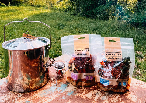
Dinner: Mama Alles Central African Peanut Stew
Day Two: 12km | Waterfalspruit Hut to Clearstream Hut
What a gorgeous day. We had a very slow start, only leaving the hut at 10:20am. The hike started with crossing a few tributary streams and heading over a few gentle rolling hills. We reached a plateau of boulders covered in red lichen, just beautiful. As we came down the hill we found a large stream which became the perfect lunch spot (only if you started the hike at 10am, otherwise you will find streams further away great for lunch). We had a long break, enjoyed a couple swims and made our lunch. There are quite a few sections of the trail where the ferns and bushes are overgrown and you can’t see the path, so wear long pants or gaiters if you don’t want your legs to get scratched. As we headed further down the valley the landscape really opened up. We had a last coffee break next to another stream (would be a good lunch spot) before we headed to the huts. As we arrived we immediately put our bags down and headed to the river below. It's worth either spending an additional night at this hut, or arriving much earlier than 5:30pm so that you can enjoy exploring the river. We swam up towards the rapids and waterfalls as the sun was setting, so spectacular.
On the menu:
Breakfast: Chia Oats with Chocolate Moondust Wazoogles
Lunch: Pasta (cooked the night before), with Mixed Dehydrated Vegetables, Canned chopped tomatoes and olives.
Dinner: Mama Alles Moroccan Tagine

Day Three: 13km | Waterfalspruit Hut to Bourke’s Luck Potholes
We left earlier on the last day as we wanted to visit some of the sites along the Blyde River circuit. The day starts with reentering the beautiful valley and heading down towards the river, through another thicket with no line of sight popped us out right next to the river. Take as many swims as you can as it becomes more difficult towards the end as the river grows too big and strong. It was a really hot day and apart from a small stretch of forest there was no shade. We came out along the pine plantations and wandered over to a lone tree to take a break in the shade. The path is not clearly marked around the gravel roads so make sure you are using your GPS to find the trail. We cruised over the hills and came down to an old ruin which set us on the final descent towards the potholes. It is only on this day that you cross the Blyde River and spend the last 200m in the 3rd largest canyon in the world. It is a truly magnificent end to a hike, we marvelled over the rock formations before we headed back to the carpark and cafe for some ice cold drinks!

On the menu:
Breakfast: Oats with a date bar.
Lunch: Leftover Tagine (we made 6 servings for 5 people and had enough for two leftover lunch servings)
I highly recommend this hike! It’s one for all levels of fitness, only 3 days and the facilities are clean and comfortable.
Leave a comment
Please note, comments must be approved before they are published